X
24" x 36" Vintage 1862 Civil War Map Wall Art Multi. Picture 1 24" x 36" Vintage 1862 Civil War Map Wall Art Multi. Picture 2 24" x 36" Vintage 1862 Civil War Map Wall Art Multi. Picture 3 24" x 36" Vintage 1862 Civil War Map Wall Art Multi. Picture 4
24" x 36" Vintage 1862 Civil War Map Wall Art Multi. The main picture.
0
Product ID: 3102405
Share
24" x 36" Vintage 1862 Civil War Map Wall Art Multi
24" x 36" Vintage 1862 Civil War Map Wall Art Multi. Picture 1 24" x 36" Vintage 1862 Civil War Map Wall Art Multi. Picture 2 24" x 36" Vintage 1862 Civil War Map Wall Art Multi. Picture 3 24" x 36" Vintage 1862 Civil War Map Wall Art Multi. Picture 4
Get $0.34 back in Rewards
Free shipping.
Estimated delivery between May 1 - May 3
Add to wishlist
-
+
ADD TO CART
Details
easy to hang or frame. does not include frame.
perfect for any room
vintage map print
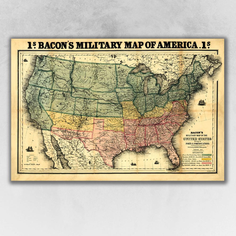
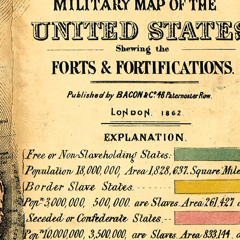
Bacon's Military Map of America, originally published in 1862 is a classic Civil War Military Map. This Map shows the forts and fortifications that existed during the time of the Civil War. The forts are named and marked by small flags. The map includes towns, railroads, names and boundaries of states and territories and is color coded to reflect the divide of the country during the war: "Free or Non-Slaveholding States" are colored green, "Border Slave States" are yellow, and "Seceded or Confederate States" are in red. Also marked on the map are Pony Express Routes and Wagon Trails such as the Oregon Trail and the Santa Fe Route that the early western settlers took. Printed on heavyweight matte art paper, this fascinating vintage looking historic poster is ready to frame, mount, or display as a poster directly on the wall.
Show more
Specifications
  • General Item Color
    Multi
  • Finish
    Matte
  • Materials
    Paper
  • Style
    Vintage
  • Item Weight (lbs.)
    0.50 Pounds
  • Item Height (in.)
    36
  • Item Width (in.)
    24
  • Item Depth (in.)
    0.1
  • Commercial Use Type
    Not Provided
  • Show more
Similar Products