X
16" x 20" Vintage 1718 Map of New France Multi. Picture 1 16" x 20" Vintage 1718 Map of New France Multi. Picture 2 16" x 20" Vintage 1718 Map of New France Multi. Picture 3 16" x 20" Vintage 1718 Map of New France Multi. Picture 4
16" x 20" Vintage 1718 Map of New France Multi. The main picture.
0
Product ID: 3102391
Share
16" x 20" Vintage 1718 Map of New France Multi
16" x 20" Vintage 1718 Map of New France Multi. Picture 1 16" x 20" Vintage 1718 Map of New France Multi. Picture 2 16" x 20" Vintage 1718 Map of New France Multi. Picture 3 16" x 20" Vintage 1718 Map of New France Multi. Picture 4
Get $0.23 back in Rewards
Free shipping.
Estimated delivery between May 2 - May 6
Add to wishlist
-
+
ADD TO CART
Details
easy to hang or frame. does not include frame.
perfect for any room
vintage map print
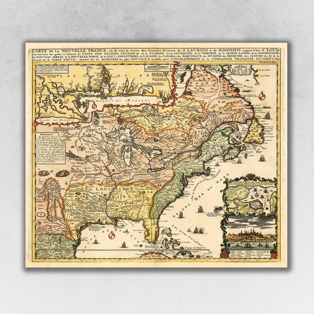
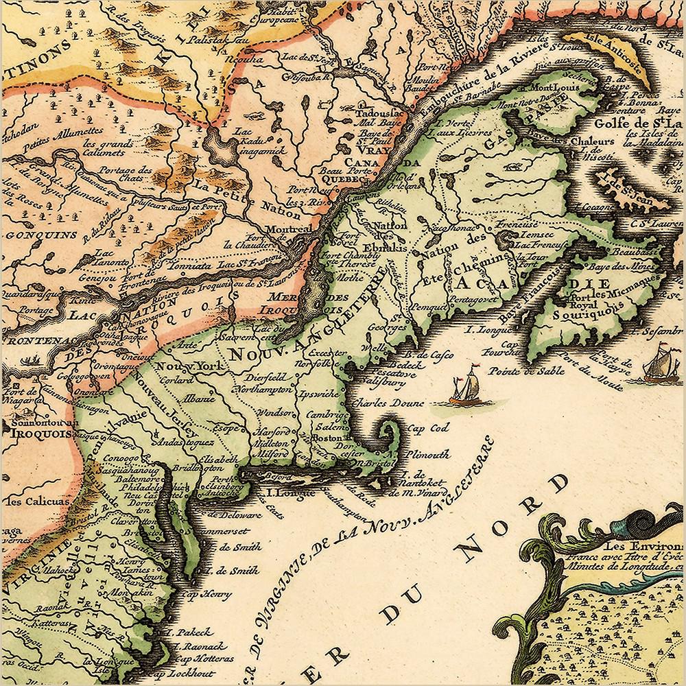
Carte De La Nouvelle France translated, Map of New France, originally published in 1718 is a classic reproduction vintage map by Henri Chatelain. This print shows the inhabited parts of North America as of the early 1700s. This map, based on the 1699 voyage of Pierre Le Moyne d'Iberville. An inset in the top left features the Mississippi Delta and Mobile Bay. The inset in the lower right includes a plan and view of Quebec Canada. Vignettes and notes throughout the map highlights many points of interest. Printed on heavyweight matte art paper, this vintage looking historic map poster is ready to frame, mount, or display as a poster directly on the wall.
Show more
Specifications
  • General Item Color
    Multi
  • Finish
    Matte
  • Materials
    Paper
  • Style
    Vintage
  • Item Weight (lbs.)
    0.38 Pounds
  • Item Height (in.)
    20
  • Item Width (in.)
    16
  • Item Depth (in.)
    0.1
  • Commercial Use Type
    Not Provided
  • Show more
Similar Products